
Best Viewpoints in Phuket in 2026: Sunset, Sunrise and Panoramic Views
Compare 12 of the best viewpoints in and near Phuket for sunset, sunrise, 360° panoramas and hikes, with access, parking, prices and safety.
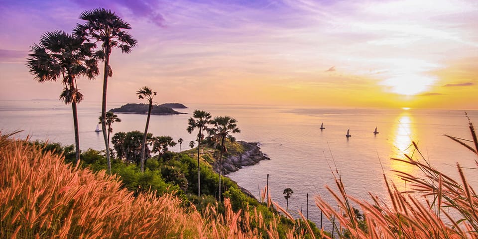
Phuket’s best viewpoints range from roadside platforms where you can stop for ten minutes to exposed capes that require a serious hike. The right choice depends on whether you want a classic Phuket sunset, an east-facing sunrise, a three-beach panorama, a city view, easy access or a quieter place away from tour buses.
This guide compares the best viewpoints in Phuket by type of view, orientation, access road, walking distance, difficulty, parking, price, crowds, facilities, accessibility, safety and photography. We checked exact Google Maps listings, official and local sources, and recent visitor reports in English, Thai, Russian and French. Information was reviewed in July 2026.
Important: Google opening hours, parking fields and prices can change or conflict with local rules. For difficult trails and religious sites, the current notice on arrival takes priority over any online listing.
Planning beach stops around the same route? See our guide to the best beaches in Phuket.
Best Phuket viewpoints at a glance
Scroll right to see the table on mobile.
| Viewpoint | Area | Type of view | Best light | Access | Walking | Difficulty | Price | Best for |
|---|---|---|---|---|---|---|---|---|
| Promthep Cape | Rawai | Open sea, islands and cape | Sunset | Paved road | Minimal at the upper viewpoint | Easy above; difficult lower trail | Main viewpoint free | Classic Phuket sunset |
| Karon Viewpoint | Kata–Karon | Kata Noi, Kata and Karon beaches | Late afternoon | Beside paved road | Minimal | Easy | Free | Best beach panorama |
| Windmill Viewpoint | Rawai / Nai Harn | Ya Nui, Koh Man and open sea | Sunset | Paved road | Minimal | Easy | Free | Easy southern sunset |
| Khao Rang | Phuket Town | City, hills and offshore islands | Late afternoon and blue hour | Paved road | Minimal at the top | Easy by vehicle | Free | City and night view |
| Monkey Hill | Phuket Town | Macaques and partial city views | Morning or late afternoon | Park low and expect to walk | Long steep climb | Moderate to strenuous | Entry generally free | Monkeys and exercise |
| Khao Khad View Tower | Cape Panwa / Wichit | 360-degree sea and island panorama | Sunrise or late afternoon | Steep paved road | Long staircase | Moderate stair climb | Free entry reported | 360° view and sunrise |
| Big Buddha | Chalong / Karon | Broad southern Phuket panorama | Morning or late afternoon | Steep paved road | Short site walk | Easy by vehicle | No confirmed admission fee | Landmark and panorama |
| Wat Doi Thepnimit | Patong | Patong, sea and mountain view | Late afternoon | Very steep paved road | Minimal at the top | Difficult drive for beginners | No confirmed entry fee | Best view over Patong |
| Black Rock Viewpoint | South Phuket | Nai Harn, capes, islands and sea | Morning or late afternoon | Rough dirt road plus trail | About 30–45 minutes from lower access | Moderate | Viewpoint free; transport extra | Best rewarding hike |
| Krating Cape | Nai Harn | Wild cape, grassland and sea | Sunset | Natural coastal trail | About 50–70 minutes each way | Moderate to difficult | Trail generally free | Wild sunset hike |
| Laem Singh Viewpoint | Kamala–Surin | Cove and forested headlands | Afternoon | Roadside stop | Minimal | Easy | Free | Quick photo stop |
| Samet Nangshe | Phang Nga, near Phuket | Karsts, mangroves and morning mist | Sunrise | Drive plus 4×4 or steep walk | Optional difficult climb | Easy with shuttle | Official reference: 30–90 THB; verify | Best sunrise near Phuket |
Samet Nangshe is not in Phuket. It is in Phang Nga province and is included only as a popular sunrise excursion from the island.
Which Phuket viewpoint should you choose?
| Your priority | Best choice | Why |
|---|---|---|
| Classic Phuket sunset | Promthep Cape | The widest open horizon and the island’s most recognisable sunset setting. |
| Three beaches in one photo | Karon Viewpoint | No hike and a clear stacked view of Kata Noi, Kata and Karon. |
| Easy sunset in south Phuket | Windmill Viewpoint | Road access with Ya Nui and Koh Man forming a stronger foreground than at Promthep. |
| Sunrise inside Phuket | Khao Khad View Tower | An early-opening 360-degree tower with east-facing views. |
| Sunrise near Phuket | Samet Nangshe | Phang Nga Bay’s limestone formations create a much more dramatic sunrise landscape. |
| Phuket Town and night lights | Khao Rang | Easy summit access, facilities and a city panorama that improves after sunset. |
| Patong from above | Wat Doi Thepnimit | A quieter temple viewpoint directly above Patong. |
| Best hike-to-view ratio | Black Rock Viewpoint | The final forest trail is manageable, although the rough access road requires planning. |
| Most adventurous sunset hike | Krating Cape | Wild coastal scenery with fewer visitors, but materially greater safety risk. |
| Wheelchair-friendly main viewpoint | Karon Viewpoint or Khao Rang | Google Places reports accessible parking and entrances at both main viewing areas. |
Detailed reviews of the best viewpoints in Phuket
1. Promthep Cape — the classic Phuket sunset
Best for: first-time visitors, open-sea sunsets and an easy viewpoint in south Phuket.
Promthep Cape remains the obvious answer for anyone asking where to see a classic Phuket sunset. The upper viewing area looks over the Andaman Sea, offshore islands and the narrow cape extending south from the island. It is not Phuket’s quietest viewpoint, but it offers the clearest combination of easy access, a broad horizon and a recognisable landscape.
The most important distinction is between the upper viewpoint and the path descending toward the cape tip. The main upper area is reached directly by paved road and requires almost no walking. The lower trail is steep, uneven and exposed. A rescue in June 2026 followed an ankle injury on this lower route, so it should not be treated as a casual extension of the main platform.
Promthep Cape quick facts
- Google rating: 4.7/5 from approximately 18,600 reviews, checked July 2026.
- Best time: arrive 45–75 minutes before sunset.
- Access: paved road to the upper viewpoint.
- Walking: minimal above; steep descent and climb for the lower cape.
- Parking: several parking options are reported, but spaces and road access tighten before sunset.
- Price: the main viewpoint is free. Any small lighthouse or museum charge should be checked locally.
- Facilities: small shops, drinks and souvenir sellers nearby; toilets were not confirmed through the new structured Places fields.
- Accessibility: accessible parking, entrance and seating are reported for the upper viewpoint only.
- Visit duration: 30–60 minutes without the lower trail.
Photography: arrive before the tour groups fill the railings. The lighthouse, palms and cape can be used as foregrounds before switching to the western horizon at sunset. During the rainy season, cloud can improve colour but can also hide the sun completely.
Pros: iconic sunset, direct road access, wide horizon and easy combination with Rawai, Nai Harn and Ya Nui.
Cons: heavy sunset crowds, exposed heat and a lower trail that is much harder than the main viewpoint.
Common mistake: arriving at the exact sunset time or descending the lower cape in unsuitable shoes.
Promthep Cape on Google Maps · Directions
2. Karon Viewpoint — the best easy panorama over three beaches
Best for: a no-hike view over Kata Noi, Kata and Karon.
Karon Viewpoint is also known as Three Bay Viewpoint, Three Beaches Viewpoint and historically Kata Viewpoint. From the roadside platform, Kata Noi appears in the foreground, Kata Beach occupies the middle of the composition and the long curve of Karon Beach continues into the distance.
This is arguably the best pure coastal panorama in Phuket for the effort required. The platform is directly beside the road, there is no meaningful hike and the composition is more detailed than the open-ocean view at Promthep. Late-afternoon light gives the beaches and green headlands more depth. Sunset can be attractive, but Karon is stronger as a three-bay viewpoint than as a direct horizon sunset location.
Karon Viewpoint quick facts
- Google rating: 4.6/5 from approximately 14,500 reviews.
- Best time: around 16:00–17:30 for warm light and better beach colour.
- Access: directly beside the paved coastal road.
- Walking: minimal.
- Parking: free parking lot and free street parking reported.
- Price: free.
- Facilities: shade and small vendors; toilets are repeatedly mentioned by visitors but were not returned as a structured Places field.
- Accessibility: accessible parking, entrance and seating are reported.
- Visit duration: 10–25 minutes.
Tour buses frequently stop here, but groups usually remain for a short time. Waiting ten minutes can substantially change how crowded the platform feels. The dangerous approach is not the viewpoint itself but the steep, busy coastal road: walking to Karon Viewpoint from Kata or Nai Harn is not recommended.
Photography: the classic frame places Kata Noi nearest, Kata in the centre and Karon in the distance. A moderate telephoto lens compresses the three beaches; a wide lens includes more vegetation and sky.
Pros: Phuket’s strongest three-beach composition, no hike, free parking and useful accessibility.
Cons: tour-bus stops, roadside traffic and limited reason to stay after the light fades.
Common mistake: confusing Karon Viewpoint with the separate and much less useful “Kata Noi Viewpoint” Google listing.
Karon Viewpoint on Google Maps · Directions
3. Windmill Viewpoint — an easy southern sunset
Best for: a sunset near Nai Harn with Ya Nui Beach and Koh Man in the foreground.
Windmill Viewpoint sits between Nai Harn and Promthep Cape. Its view is smaller in scale than Promthep, but often more visually interesting: Ya Nui Beach, Koh Man and the surrounding headlands create layers in front of the open sea.
The viewpoint is reached by paved road and requires almost no walking. Its main weakness is parking. Spaces are limited and late arrivals may need to continue past the viewpoint rather than stop safely. Windmill is no longer a hidden alternative, particularly during high season and clear sunset evenings.
Windmill Viewpoint quick facts
- Google rating: 4.7/5 from approximately 6,400 reviews.
- Best time: arrive 45–60 minutes before sunset.
- Access: paved road to the viewpoint.
- Walking: minimal.
- Parking: free parking and street parking reported, but capacity is limited.
- Price: free.
- Facilities: a shaded sala and a small drinks or ice-cream vendor are commonly reported.
- Accessibility: the main view is close to parking, but Google did not return a structured accessibility confirmation.
- Visit duration: 20–45 minutes.
Photography: photograph Ya Nui and Koh Man while the foreground still has light, then turn toward the western horizon. Wind and sudden showers are common in the green season, and the grass and parking edges can become slippery.
Pros: excellent sunset, easy access, strong foreground and close to Ya Nui and Promthep.
Cons: limited parking, exposed weather and no confirmed toilets.
Common mistake: arriving at sunset with no parking margin.
Windmill Viewpoint on Google Maps · Directions
4. Khao Rang Viewpoint — the best view over Phuket Town
Best for: city views, evening lights, families and visitors who want facilities without a hike.
Khao Rang offers a different Phuket panorama. Instead of a single beach or western horizon, it looks over Phuket Town, surrounding hills, the direction of Chalong Bay and offshore islands. The view becomes more interesting during blue hour, when city lights appear below the darker hills.
This is one of the most practical viewpoints on the island. A paved road reaches the summit, parking is available, toilets are confirmed through Places API (New), and restaurants are located around the hill. Visitors can also walk up from town, but the climb is strenuous in Phuket’s heat.
Khao Rang quick facts
- Google rating: 4.5/5 from approximately 7,000 reviews.
- Best time: late afternoon through early evening.
- Access: paved road to the summit.
- Walking: minimal at the upper area; strenuous if walking from town.
- Parking: free lot and street parking reported.
- Price: free.
- Facilities: toilets, park areas and nearby restaurants.
- Accessibility: accessible parking, entrance and restroom are reported.
- Visit duration: 30–60 minutes.
Monkeys can appear around the hill. Keep food inside bags and do not leave drinks or small belongings unattended. Khao Rang is generally calmer than Promthep or Karon, although weekends and sunset can still bring local visitors.
Photography: Khao Rang is best for city layers, long-lens views, blue-hour lights and changing weather over the hills. It is not the place for a clean beach or open-horizon sunset.
Pros: best city view, facilities, accessibility and a worthwhile view after sunset.
Cons: less dramatic than the coastal cliffs and occasional monkey nuisance.
Common mistake: expecting a view similar to Karon or Promthep.
Khao Rang on Google Maps · Directions
5. Monkey Hill Viewpoint — macaques, exercise and partial city views
Best for: seeing macaques and combining wildlife with a steep walk near Phuket Town.
Monkey Hill is popular, but the name creates the wrong expectation for some visitors. The macaques and the walk are the main attractions; the panorama is secondary and some of the better openings appear before the upper end of the route.
Recent local guidance in 2026 reports that tourist motorcycles are no longer allowed farther up the hill. Current visitor accounts also describe restricted car access. The safest planning assumption is to park near the lower entrance and expect to walk. A local cart or tuk-tuk service may operate, but no reliable official schedule or fixed price was found.
Monkey Hill quick facts
- Google rating: 4.4/5 from approximately 3,500 reviews.
- Best time: early morning for cooler walking or late afternoon with enough daylight to descend.
- Access: park low and expect a long paved-road climb.
- Walking: long and steep if no local transport is operating.
- Difficulty: moderate to strenuous in heat.
- Price: entry is generally reported free; local transport prices are variable and unconfirmed.
- Facilities: rest points, exercise equipment, cafés and toilets are reported along the route.
- Children: not ideal for small children because of macaques, heat and the climb.
- Visit duration: 90–150 minutes on foot.
Monkey safety: do not carry visible food, plastic drink bags or open bottles. Do not feed, touch, corner or provoke macaques. Keep sunglasses, phones and loose items secure. Their behaviour can change quickly when food is involved.
Photography: this is better for animal and street-style images than for an unobstructed landscape. Use distance rather than moving close to monkeys for a photograph.
Pros: distinctive wildlife experience, free entry reports, exercise and proximity to Phuket Town.
Cons: steep climb, uncertain transport rules, macaque risk and a partly obstructed summit view.
Common mistake: carrying visible food or assuming the summit has the best panorama.
Monkey Hill on Google Maps · Directions
6. Khao Khad View Tower — Phuket’s best 360-degree viewpoint
Best for: a quiet 360-degree panorama and the most practical sunrise viewpoint inside Phuket.
Khao Khad View Tower, also spelled Khao Kad or Kaokard, stands above the Cape Panwa area. Unlike the west-coast viewpoints, the tower allows visitors to look in several directions over Chalong Bay, hills, islands and the wider Phuket landscape.
The road to the parking area is paved but steep. From the car park, a long staircase leads to the observation tower. Google Places reports accessible parking but explicitly reports that the tower entrance is not wheelchair accessible. This distinction matters: reaching the parking area is easy, reaching the elevated viewing platform is not possible without climbing stairs.
Khao Khad View Tower quick facts
- Google rating: 4.5/5 from approximately 1,500 reviews.
- Best time: around opening for sunrise or late afternoon for softer light.
- Access: steep paved road; no local bus was identified by the Phuket provincial page.
- Walking: long staircase from parking to the tower.
- Parking: a large parking area is reported. Google returns both free and paid parking signals, so current signs take priority.
- Price: free entry is reported by recent local guides.
- Hours: Google shows 06:00–19:00; recent local guidance gives approximately 06:00–18:00. Arrive well before the earlier closing time.
- Facilities: a small café or shop is reported near the parking area; toilets were not confirmed.
- Visit duration: 45–75 minutes.
Khao Khad is usually much quieter than the famous sunset stops. It is also the strongest sunrise candidate inside Phuket because its early opening and 360-degree platform provide east-facing angles. The view is broader than it is dramatic: expect an expansive survey of the island rather than a single iconic foreground.
Photography: use a wide lens or stitched panorama. Morning haze can reduce detail, while post-rain air can provide exceptional visibility. Wet stairs are the main rainy-season hazard.
Pros: 360-degree view, low crowds, large parking area and strong sunrise potential.
Cons: many stairs, remote without private transport and conflicting closing times.
Common mistake: confusing the tower with lower roadside viewpoints carrying similar Khao Khad or Cape Panwa names.
Khao Khad View Tower on Google Maps · Directions
7. Big Buddha Viewpoint — temple and panoramic views
Best for: combining one of Phuket’s major landmarks with a high view over southern Phuket.
The Big Buddha site reopened on 3 March 2026 after the closure that followed the 2024 landslide. It can therefore be included again, but the site is operating under reopening conditions and should not be treated as an unrestricted viewpoint.
The elevated terraces look toward Chalong Bay, the Kata side and the hills of southern Phuket. The paved road reaches parking near the temple, although it is steep in places. Google Places reports accessible parking, entrance and toilets, but individual terraces, slopes and steps can still limit movement.
Big Buddha quick facts
- Google rating: 4.6/5 from approximately 38,800 reviews.
- Best time: morning after opening or late afternoon with enough time before closing.
- Official hours: 09:00–18:00 daily according to the March 2026 reopening report. Google currently shows longer hours; use the official schedule.
- Access: paved hill road with parking near the temple.
- Walking: a short site walk with slopes and steps depending on the terrace.
- Price: no mandatory entry fee was confirmed; donations or clothing-cover arrangements may apply.
- Facilities: toilets, café and gift shop reported.
- Visit duration: 60–90 minutes.
This is an active religious site. Cover shoulders and knees, follow signs, keep noise low and respect any area closed to visitors. Monkeys may also target visible food around the hill.
Because the closure was landslide-related, checking the current official notice is particularly important after prolonged heavy rain. The longer hours shown on Google should not be used to justify arriving before the official opening or remaining after the official closing time.
Photography: combine temple architecture with the broad panorama, but follow any restrictions on photographing worship areas or people.
Pros: major landmark, wide view, parking, toilets and a cultural visit in the same stop.
Cons: crowds, strict conduct requirements, conflicting online hours and recent closure history.
Common mistake: treating the temple as only a photo platform or trusting the longer Google schedule.
Big Buddha on Google Maps · Directions · March 2026 reopening report
8. Wat Doi Thepnimit — the best viewpoint over Patong
Best for: a quiet elevated view over Patong in a temple setting.
Wat Doi Thepnimit provides the most differentiated viewpoint near Patong. From the hill, visitors can look over the town, western sea and surrounding mountains while using the pagoda as a foreground.
The top requires little walking once parked, but the access road is very steep. It is paved, yet the gradient and descent can be difficult for inexperienced scooter riders, especially in rain. A car or experienced driver is the safer choice. Visit in daylight if you do not know the route.
Wat Doi Thepnimit quick facts
- Google rating: 4.8/5 from approximately 470 reviews.
- Best time: late afternoon before sunset.
- Hours: Google listing 07:00–20:00.
- Access: paved but very steep road.
- Walking: minimal after parking.
- Parking: visitor reports describe parking at the top.
- Price: no confirmed entry fee.
- Facilities: toilets confirmed.
- Accessibility: accessible parking and entrance are reported, although local slopes still require caution.
- Visit duration: 30–60 minutes.
Some reviews mention sunrise, but the listed 07:00 opening is later than sunrise during much of the year. Doi Thepnimit should therefore be recommended primarily for afternoon and sunset light, not as a dependable sunrise viewpoint.
As at Big Buddha, this is a temple rather than a commercial observation platform. Dress conservatively and keep noise low.
Pros: best Patong panorama, quiet atmosphere, parking at the top and temple architecture.
Cons: steep approach and religious etiquette requirements.
Common mistake: attempting the climb on an underpowered scooter without hill experience.
Wat Doi Thepnimit on Google Maps · Directions
9. Black Rock Viewpoint — Phuket’s most rewarding viewpoint hike
Best for: hikers and photographers wanting a wild panorama over south Phuket.
Black Rock Viewpoint looks over Nai Harn, Promthep Cape, the southern coastline, islands and open sea. The final forest trail is not exceptionally long, but reaching it is the complicated part.
The approach follows the Nui Beach road and then an unpaved section used by scooters, ATVs, buggys and local 4×4 vehicles. Recent 2026 reports describe heavy dust, poor signs and normal Grab drivers stopping before the rough section. The distance quoted online varies because visitors begin walking from different parking or drop-off points.
Black Rock quick facts
- Google rating: 4.8/5 from approximately 900 reviews.
- Best time: morning for cooler conditions or late afternoon with a large daylight margin.
- Access: rough dirt-road approach followed by a forest path.
- Walking: roughly 30–45 minutes from the lower access used by many normal vehicles; shorter if a suitable local vehicle continues farther.
- Difficulty: moderate, but harder in heat, dust or rain.
- Parking: parking is reported near different trail starts; follow current local signs.
- Price: the viewpoint is generally free. Recent visitors reported about 200 THB per person for an informal return 4×4 ride, but this is not an official tariff.
- Facilities: no dependable facilities at the viewpoint; carry water.
- Accessibility: not accessible.
- Visit duration: 90–150 minutes depending on the drop-off point.
Commercial ATV tours are a separate activity and cost substantially more than an informal local ride. Do not assume an advertised ATV package represents the cost of basic transport to the trail.
Rain warning: do not continue on the dirt road with a normal scooter after heavy rain unless you have the vehicle, tyres and experience for slippery off-road conditions. Treat the “24 hours” Google listing as a database field, not a safety recommendation. Visit in daylight.
Photography: Black Rock offers one of the best layered views in Phuket. A wide lens captures Nai Harn and the southern capes; protect cameras from dust on the road.
Pros: exceptional panorama, fewer crowds and a rewarding hiking experience.
Cons: dirt road, dust, weak signs, variable transport costs and weather-sensitive access.
Common mistake: quoting one universal hike distance without stating the starting point.
Black Rock Viewpoint on Google Maps · Directions
10. Krating Cape — a difficult wild sunset hike
Best for: prepared hikers seeking wild sunset scenery and low crowds.
Krating Cape, also written Laem Krathing, combines coastal rocks, grassland, steep trail sections and an open sunset horizon. It is visually strong but carries more route and timing risk than Black Rock.
The clearest first-time route begins around Nai Harn. Park at Nai Harn when possible, walk approximately 1 km toward the Baan Krating Resort boundary, continue along the coastal rocks and then follow the established cliffside trail. Allow roughly 50–70 minutes each way, including the approach. Alternative routes from the Black Rock side exist, but they can leave visitors with a difficult uphill return after sunset.
Krating Cape quick facts
- Google rating: 4.8/5 from approximately 700 reviews.
- Best time: late afternoon, while turning back early enough to complete the return in daylight.
- Access: natural coastal and cliff trail from the Nai Harn/Baan Krating side.
- Walking: approximately 50–70 minutes each way; exact distance varies by parking point.
- Difficulty: moderate to difficult, with rocks, slopes and uneven terrain.
- Parking: use Nai Harn parking when possible. Resort or roadside arrangements can change and may involve a charge or minimum spend.
- Price: the trail is generally free; parking or local transport can cost extra.
- Facilities: none dependable on the trail.
- Children: Places explicitly reports the attraction as not good for children.
- Visit duration: 2–3 hours including a safety margin.
Visitors have required rescue after becoming lost after dark, and another visitor suffered a broken ankle after slipping on rocks. Rawai Municipality has advised visitors to remain on the existing route.
Do not wait for full darkness before returning. Wear closed shoes, carry water and a light, save an offline map and avoid the route during heavy rain, thunderstorms or when the rocks and grass are wet.
Photography: the strongest images use the grass, rocks or cape as a foreground before sunset. A headlamp is emergency equipment, not a reason to remain at the viewpoint after dark.
Pros: wild sunset scenery, low crowds and a distinct hiking experience.
Cons: rescue history, route ambiguity, no facilities and no suitability for limited mobility.
Common mistake: staying for the final colour and beginning the most difficult part of the return after dark.
Krating Cape on Google Maps · Directions · Tourism Authority route information
11. Laem Singh Viewpoint — a quick roadside photo stop
Best for: a short stop between Kamala and Surin with almost no walking.
Laem Singh Viewpoint looks down toward the cove and forested headlands of Laem Singh Beach. It is easy to include while travelling along the west-coast road and requires only a short stop.
The viewpoint is not a dependable sunset winner. Recent visitors report that vegetation can block the direct evening sun depending on the season and current tree growth. Afternoon is usually better for seeing the colour of the cove.
Laem Singh Viewpoint quick facts
- Google rating: 4.7/5 from approximately 1,800 reviews.
- Best time: afternoon for cove colour and visibility.
- Access: direct roadside stop.
- Walking: minimal.
- Parking: free parking is reported, but take care when entering and leaving the road.
- Price: free.
- Facilities: occasional coconut or drinks vendor; no confirmed toilets.
- Visit duration: 10–20 minutes.
The viewpoint should not be confused with access to Laem Singh Beach. The old staircase historically associated with the beach is not a reliable public access route. Reaching the beach is a separate question and should not be inferred from the viewpoint listing.
Pros: extremely easy, distinctive cove photo, free and useful on a Kamala–Surin itinerary.
Cons: trees can obstruct sunset, limited facilities and roadside traffic.
Common mistake: assuming the viewpoint provides direct beach access.
Laem Singh Viewpoint on Google Maps · Directions
Black Rock vs Krating Cape: which hike should you choose?
| Criterion | Black Rock | Krating Cape |
|---|---|---|
| View | Layered panorama over Nai Harn, capes and islands | Open wild cape and sunset horizon |
| Main challenge | Rough dirt-road approach, dust and poor signs | Long natural trail, rocks and returning before dark |
| Walking | Usually 30–45 minutes from a lower vehicle stop, but varies | Approximately 50–70 minutes each way via Nai Harn/Baan Krating |
| Difficulty | Moderate | Moderate to difficult |
| Best time | Morning or late afternoon | Late afternoon with an early return |
| Rain suitability | Poor: dirt road and trail become slippery | Very poor: rocks, grass and slopes become hazardous |
| Children | Only capable older children with close supervision | Not recommended |
| Best choice for most hikers | Black Rock | Only for prepared visitors prioritising wild sunset scenery |
Confusing or currently questionable Phuket viewpoints
Radar Hill
Radar Hill should not currently be recommended as a main viewpoint. Sources agree that a military or restricted area exists near the summit, but disagree on whether a useful legal public view remains before it. Other reports say vegetation now blocks former stopping points. Without current official confirmation of a legal, unobstructed public platform, the potential view does not justify directing readers into an uncertain restricted area.
Kata Noi Viewpoint
A separate Google listing exists, but reports describe a roadside or café area with poor parking and inconsistent value. It is also confused with Karon Viewpoint, which was historically called Kata Viewpoint. For the recognised view over Kata Noi, Kata and Karon, use the exact Karon Viewpoint listing above.
Kalim Viewpoint
Kalim Viewpoint has a quiet west-facing view, but recent reports describe an extremely steep approach, difficult descent and vegetation blocking part of the panorama. It may interest confident local drivers or hikers near Patong, but the access risk and effort are disproportionate for most visitors.
Cape Panwa Viewpoint
Several listings and articles mix Cape Panwa promenade, the aquarium area, lower roadside viewpoints and Khao Khad View Tower. The standalone “Cape Panwa Viewpoint” review set is too mixed to support a reliable recommendation. Use the exact Khao Khad View Tower listing for the verified 360-degree experience.
Best viewpoint near Phuket: Samet Nangshe
Samet Nangshe Viewpoint is in Phang Nga province, not Phuket. It is included because it is the strongest sunrise excursion in the wider Phuket travel area and receives substantial search demand from visitors staying on the island.
The view looks over the limestone karsts and mangroves of Phang Nga Bay. At sunrise, the islands become silhouettes against the eastern sky. During the rainy season, low cloud or mist can create a more dramatic scene, although heavy cloud can also remove the sunrise completely.
Samet Nangshe quick facts
- Google rating: 4.7/5 from approximately 9,200 reviews.
- Best time: arrive before sunrise.
- Hours: Google listing 05:30–19:00.
- Access: drive off Phuket island into Phang Nga, park below and use the steep local 4×4 or walk.
- Difficulty: easy with the shuttle; difficult on foot, particularly before sunrise.
- Official published reference price: 30 THB to walk or 90 THB including the local return vehicle.
- Current-price warning: recent visitors sometimes report 100–150 THB, so verify at the signed entrance.
- Accessibility: parking and entrance are reported as not wheelchair accessible.
- Facilities: café, restaurant and photo platforms are reported at the top.
- Visit duration: allow a half day from most of Phuket and longer from Rawai, Kata or Patong.
Follow signs for the original Samet Nangshe Viewpoint. Do not confuse it with Beyond Skywalk Nangshi or other nearby private attractions, which have separate entrances and substantially higher prices.
Walking before sunrise requires a light and careful footing. The final road is steep and the 4×4 ride can be rough. Sunrise and weekends attract the largest crowds.
Pros: exceptional sunrise, unique karst landscape, shuttle option and strong photography potential.
Cons: outside Phuket, long drive, variable price reports and map confusion with private alternatives.
Common mistake: calling it a Phuket viewpoint or following the wrong paid attraction on Google Maps.
Samet Nangshe Viewpoint on Google Maps · Directions · Official Thai access and price reference
Map of the best viewpoints in Phuket
Use the exact listings below rather than generic searches, which can lead to duplicate viewpoints, restaurants or private attractions with similar names.
- Promthep Cape
- Karon Viewpoint
- Windmill Viewpoint
- Khao Rang Viewpoint
- Monkey Hill Viewpoint
- Khao Khad View Tower
- Big Buddha
- Wat Doi Thepnimit
- Black Rock Viewpoint
- Krating Cape
- Laem Singh Viewpoint
- Samet Nangshe Viewpoint in Phang Nga
How to choose the right Phuket viewpoint
Sunset or sunrise
For a direct sunset over the sea, choose Promthep Cape, Windmill Viewpoint or Krating Cape. Karon Viewpoint is better for warm late-afternoon light across beaches than for an unobstructed horizon. For sunrise inside Phuket, Khao Khad View Tower is the most practical option. For the strongest sunrise landscape near Phuket, travel to Samet Nangshe in Phang Nga.
Easy access or hiking
Karon, Windmill, Promthep’s upper viewpoint, Khao Rang and Laem Singh require little walking. Khao Khad requires many stairs. Black Rock involves a rough approach and a forest trail. Krating Cape is the most demanding route in this guide.
Beach, city or island views
Choose Karon for beaches, Khao Rang for Phuket Town, Doi Thepnimit for Patong, Khao Khad for a broad multi-direction panorama and Samet Nangshe for limestone islands.
Families and limited mobility
Karon and Khao Rang have the strongest structured accessibility signals. Promthep’s upper area also reports accessible parking, entrance and seating. Khao Khad’s parking area is accessible, but the tower is not because of the staircase. Black Rock and Krating Cape are not accessible. Monkey Hill is unsuitable for many families because of the steep walk and macaques.
Crowds
Promthep is the most crowded at sunset. Karon receives frequent tour buses, although they usually stop briefly. Windmill has a smaller parking area and can feel crowded quickly. Khao Khad, Doi Thepnimit and Black Rock are generally quieter.
Rainy-season conditions
Paved viewpoints remain usable in light rain, but clouds can remove the view. Black Rock’s dirt road and Krating Cape’s rocks and grass become materially more dangerous when wet. Big Buddha access should be checked after prolonged heavy rain because the site’s recent closure was related to a landslide.
Viewpoint safety in Phuket
- Do not treat “open 24 hours” on Google as a trail-safety recommendation. Black Rock and Krating Cape should be completed in daylight.
- Carry water. Exposed viewpoints and steep climbs become difficult quickly in Phuket’s heat.
- Wear closed shoes for trails. Flip-flops are unsuitable for the lower Promthep path, Black Rock and Krating Cape.
- Do not display food around macaques. This applies at Monkey Hill, Khao Rang and Big Buddha.
- Avoid inexperienced scooter riding on steep or unpaved access roads. Wat Doi Thepnimit, Khao Khad, Black Rock and parts of the Samet Nangshe approach require extra caution.
- Save offline directions. Mobile reception and signs are not reliable on every trail.
- Check current notices. Religious sites, restricted areas, parking arrangements and private access rules can change faster than travel articles.
Frequently asked questions about Phuket viewpoints
What is the best viewpoint in Phuket for sunset?
Promthep Cape is the best classic sunset viewpoint because it combines an open western horizon with easy road access. Windmill Viewpoint is the best easy alternative with a stronger beach-and-island foreground. Krating Cape offers the wildest sunset but requires a difficult hike and a daylight return plan.
What is the best viewpoint in Phuket for sunrise?
Khao Khad View Tower is the best practical sunrise viewpoint inside Phuket because it opens early and provides east-facing views from a 360-degree platform. Samet Nangshe offers the most dramatic sunrise near Phuket, but it is in Phang Nga province.
Which Phuket viewpoint has the best beach view?
Karon Viewpoint has the clearest beach panorama, showing Kata Noi, Kata and Karon in one frame.
Which Phuket viewpoints require no hike?
Karon Viewpoint, Windmill Viewpoint, Promthep’s upper viewpoint, Khao Rang and Laem Singh are all close to parking. Big Buddha and Wat Doi Thepnimit also require little walking after driving to the top, although their access roads are steep.
Which Phuket viewpoint is best for wheelchair users?
Google Places reports accessible parking and entrances at Karon Viewpoint and Khao Rang, with accessible seating at Karon and an accessible restroom at Khao Rang. Promthep’s upper area also has positive accessibility fields. Conditions can still change, so confirm the exact route and parking position before travelling.
Is Black Rock Viewpoint difficult?
The final forest trail is moderate, but the rough, dusty and poorly signed access road makes the overall visit harder. Walking time varies according to where a vehicle stops. Avoid the dirt road after heavy rain unless you have suitable transport and off-road experience.
Is Samet Nangshe in Phuket?
No. Samet Nangshe Viewpoint is in Phang Nga province. It is a popular sunrise excursion from Phuket but should not be described as a Phuket viewpoint.
Final verdict
For most first-time visitors, the strongest combination is Karon Viewpoint for the beach panorama and Promthep Cape or Windmill Viewpoint for sunset. Khao Rang is the best city option, Khao Khad View Tower is the best 360-degree and sunrise option inside Phuket, and Black Rock is the best hike for travellers who want a wilder view without taking on the greater risk of Krating Cape.
No single viewpoint is best for every visitor. Choose according to the light, access, weather and amount of walking you are prepared to do rather than simply following the most famous name.