
Thais are delighted! NASA releases satellite images of Krabi province, a world-famous tourist destination
Thais are delighted! NASA releases satellite images of Krabi province, a world-famous tourist destination — confirmed details at this stage for Phuket readers.
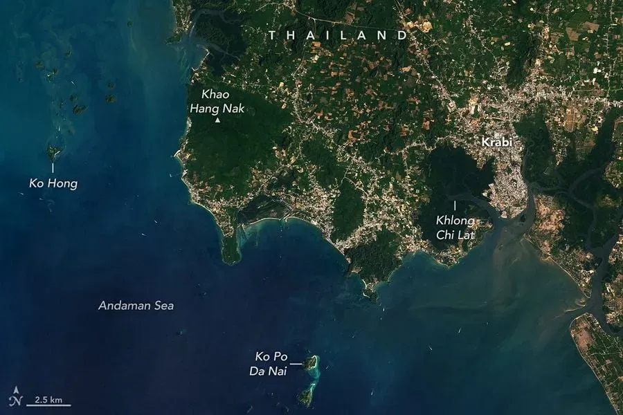
NASA Earth Observatory published new satellite images of Krabi’s coastline on April 22, highlighting the province’s distinctive geography and its proximity to Phuket. The images, captured by the Operational Land Imager (OLI) on Landsat 8 on March 23, 2026, show long stretches of bright brown sand bordering the Andaman Sea, with beaches located about 50 kilometres east of Phuket across Phang Nga Bay.
Unique Coastal Geography and Tourism Appeal
The satellite imagery reveals how Krabi’s wide beaches fill the spaces between dramatic limestone peaks, dense mangroves, and developed urban areas. These beaches are internationally recognised as major tourist destinations, drawing visitors from around the world.
Railay and Phra Nang beaches are especially popular among rock climbers, featuring steep limestone cliffs formed by ancient marine deposits and shaped over millions of years by tectonic uplift and acidic tropical rainfall. Offshore, islands such as Poda and Hong are noted for their caves and cliffs, attracting kayakers and sightseers.
Inland, the landscape transitions from lush viewpoints like Khao Hang Nak to mangrove forests along the Klong Jilad canal. The region also includes orderly agricultural zones with palm oil and rubber plantations, as well as the expanding urban area of Krabi town.
Source: https://www.dailynews.co.th/news/5801705/